Deerfield River Rapids at a Glance
The Zoar Gap Section
From Fife Brook Dam in Florida, Massachusetts to the Number 4 dam in Buckland, the Deerfield River flows unimpeded for 17 miles. The longest stretch without a dam on the main river, this run is also among the most heavily used by whitewater paddlers.
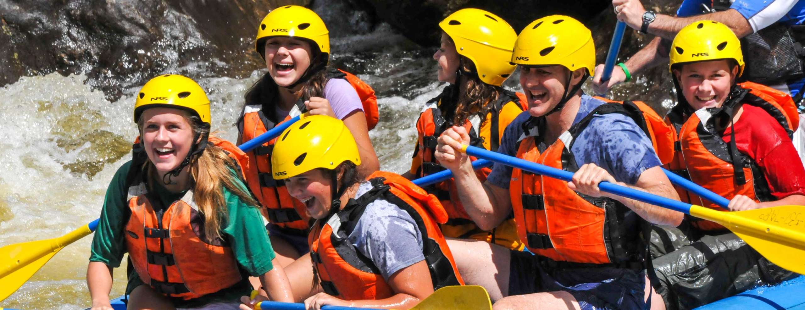
From a kayaking, canoeing, or whitewater rafting perspective, the most prominent feature on this section is Zoar Gap, a class III-III+ rapid five miles downstream from the dam. With excellent wildlife, bird species include red tail hawks, ospreys, bald eagles, and blue herons and active beavers can be often seen along the Deerfield’s banks.
Putting in at the Fife Brook Dam access area, the run begins with some fast water followed by the first class II rapid, Hurricane Hole. The lead-in to this rapid contains a few moderate-sized surfing waves. On the river left and right, large eddies offer good places to stop and paddle back up into the rapid to surf the waves. This first drop is an excellent learning site for paddlers because the pool below it makes rescue a breeze and eddy lines and waves are well defined.
A mile or so downstream of the put-in, after a sharp left-hand turn, a decaying dam abutment is visible deep in the woods on the left bank. Look carefully at the right bank and you’ll notice that what appears to be a natural escarpment is, in fact, a manmade cut through bedrock forming a canal that once carried water half a mile downstream to a stone mill building for mechanical hydropower. This power was used to excavate the Hoosac Tunnel during its construction.
A couple of class II rapids follow the abutment. The second, Freight Train, following the channel left of the island, holds some interesting surfing waves and a swirly eddy-line for squirting at levels around 1000 cubic feet per second (CFS). Looking to the right at the base of this rapid, the remains of the mill building are still visible as stone walls, columns and lintels that have withstood the weather.
Just downstream of the mill building a railroad bridge leads to the eastern entrance of the Hoosac Tunnel. Originally conceived as an aqueduct connecting a nationwide system of canals, the tunnel took so long to plan and gain legislative approval for that by the time it was built, the trend favored railroads over canals. Engineers working on the tunnel pioneered the use of Nitroglycerine in such construction applications and showed their surveying skills by coming within one and a half inches of meeting dead-on as they dug from both ends toward the middle. In 20 years of tunnel construction, 195 men were killed.
In the 1870s, at the time of its completion, the Hoosac ranked as the nation’s longest tunnel at more than 25,000 feet in length, and was hailed as an engineering marvel. While it is still in use, rail traffic on it has slowed to a crawl, making it more of an historic landmark than the crucial transportation link it once was from North Adams to Boston. There is talk in the Statehouse of revitalizing the line to give Boston a competitive advantage as an international shipping center.
After the railroad bridge, the river follows a section of shoals as the river widens and flattens out. Choose the deepest channels here, since there are several sections where a boat will easily run aground. As you float through these shoals, you pass under the Bridge to Nowhere, so named because it crosses from Florida into Rowe on what used to be a town road leading northeastward into the center of Rowe. The road is now maintained only as far as the two remaining homes on the Rowe side of the river, but its former path can be traced by walking up and over the mountain as it passes a few abandoned farms.
About a mile past the Bridge to Nowhere, the river turns sharply left and enters a mile-and-a-half-long class II section called Pinball, one of the more interesting rapids on this stretch. With numerous large boulders forming excellent eddies and a few tight slots, several small surfing waves, and plenty of places to rest or recover, this rapid is a great play spot for beginning to intermediate boaters, and makes a perfect instructional area.
The final rapid in this section ends in a large, deep pool across from a rock outcropping. The small patch of sand on the river at the left is known as Miami Beach because of its proximity to Florida, MA (which happens to be one of the coldest towns in the state). This is a nice place to stop for lunch or a breather. A few surfing waves appear in the rapid above the beach at most levels.
Continuing past Miami Beach, stay left of the large island, since at most levels the right side is too shallow to get down to without scraping. Another class II rapid follows the island around, then back right, and ends in a pool with panoramic views straight ahead of Negus Mountain, named after a colonial British colonel.
Past the pool, the river becomes shoaly again as it prepares for the largest rapid on this section, Zoar Gap. A saddle in the ridge line on river right provides a geologic clue to the origin of the Gap. Downhill from the saddle, a hummock sits just above the river. Formed by an ancient landslide, the hummock is slowly calving off into the river, clogging the Gap with rocks of all sizes and creating the turbulent whitewater that makes it so popular with boaters.
The well-landscaped eastern face of the hummock is a sign of the highway department’s frustration with nature. After losing sections of River Road into the Gap nearly every year, the state finally decided to hasten erosion a bit. Cutting the slope back to a lower angle of repose also caused a few more rocks to drop into the river, narrowing it in sections and forming more good eddies on river right.
There is a takeout on the right side as you approach Zoar Gap, but it is several hundred yards upstream of the rapid, so you have to be aware to stay to the right well above the rapid to avoid being drawn into the Gap. There is a medium-sized eddy on river left above the Gap and a few small ones on river right. Many parties scout or portage the Gap, not because of its difficulty per se, but because it is at least a grade harder than anything else on this section. Paddlers not comfortable in Class III water should think twice before attempting the Gap. Zoar Gap can be scouted from either side of the river, but if you choose river left, be aware that the railroad tracks are in use and that you may be trespassing on railroad property.
There are several options for running the main drop. A ledge on river left and a large boulder on river right, both slightly submerged at levels around 1,000 CFS, form the central tongue, the main route through the Gap. After entering the tongue, the straightest route is slightly river right to avoid two wave-holes left of center.
Another option starts in the center of the main tongue and cuts left into the tail of the big left eddy. This leaves you heading straight for O.S. Rock, which you can then quickly sidestep to the right, following the current. This route is tricky because of the eddy currents you must cross, but it is probably the most fluid of the three runs, avoiding the stern-crunching drops of the other two lines. To get a sense of the power of the Gap, catch the eddy on river left just above the three slots, and ferry over to the eddy on river right, a class IV move in a class III rapid.
As the river forms a pool at the base of the main rapid, a surfing wave, accessible from eddies on both sides, spans the river. The river right eddy also provides a good rescue spot or a resting place just below the drop. Following this eddy the river drops again through a maze of boulders.
There are several good take-outs below the Gap. A trail leads up the slope on river left about 100 feet upstream of the bridge. Around the bend below the bridge a trail leads up to the power company picnic area.
Paddling Below The Gap
You can continue a run below the Gap for as much as 12 more miles. Several more class II rapids and some swimming holes are found in this section. There are many take-outs along the way, but be careful to respect private property; below the Gap river frontage belongs mostly to individuals.
The next day’s release level is available after 5 p.m. each day. It takes the water about two hours to reach Zoar Gap from the dam. A schedule of release dates for each season is on the water line website as well.
Charlemont to Shelburne Falls
Paddlers looking for a milder whitewater run can enter the river in Charlemont at the Shunpike rest area just east of the Indian Bridge on Route 2 for several miles of class I-II water. A couple of class I-II rapids follow before you pass under the Route 8A bridge in the center of Charlemont. Stay clear of bridge abutments. The best route is right down the middle of the river. Two more class I-II rapids are found between this bridge and the take-out, about six miles downstream, but for the most part, the river is fast-flowing and unobstructed.
A good take-out is a small boat launch next to Route 2 on river left as the river enters the deadwater above the Number 4 dam. The section ends at the Number 4 dam, next to a bridge on Route 2 just upstream of Shelburne Falls.